
Geography
Geography
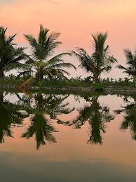
Kodamthuruth Grama Panchayat is located at 9.44° North latitude and 76.20° East longitude. The geographical features of this Panchayat are highly diverse.
Geologists believe that the Arabian Sea, which once extended up to the western borders of the taluks of Thiruvalla, Changanassery, and Kottayam, receded around the 4th century AD, leading to the formation of Cherthala Taluk, where this Panchayat is situated.
It is also believed that Vembanad Lake, including Ulaveypu Kayal forming the eastern boundary of the Panchayat, originated as a result of an earthquake.
This region was once densely forested, and evidence of later marine transgression can be seen in the abundance of seashell deposits found here. Even today, areas beyond the western boundary of the Panchayat are occasionally affected by sea incursions.
Except for the banks of Vembanad Lake, most parts of the Panchayat consist of sandy terrain, while the lake shores are marshy in nature.